6 Top Day Hikes In Tuolumne Meadows
In: Trail Notes
Tuolumne Meadows in Yosemite National Park is a place I love exploring! It is a place I patiently wait almost all year long to open. Tuolumne Meadows is a place I love exploring more than any other area in the park. Tuolumne Meadows sits at 8,600 feet and it is of the largest high-elevation meadows in the Sierra Nevada,. Backpacking, rock climbing, day hiking, camping is addicting. No other place for me in the park is exciting as exploring Tuolumne Meadows. Questions and answers listed below are documented for my own personal use. Feel free to check it out.
What is Tuolumne Meadows?
Tuolumne Meadows is a gentle, dome-studded, sub-alpine meadow area along the Tuolumne River in the eastern section of Yosemite National Park.
How did Tuolumne Meadows form?
There was a time in history when the snow did not melt during summer in Tuolumne. The accumulated snow turned to ice. As the ice depended, its weight caused it to flow as a glacier down the canyon to the west. Glaciers formed in Tuolumne Meadows many times in the past two million years. As recently as 20,000 years ago. Glaciers covered all but the highest jagged peaks around Tuolumne Meadows. After the glaciers melted, shallow, broad depressions in the bedrock began to fill with sand. Because granite basins hold spring snowmelt, some areas were too wet for trees. Sedges and grasses thrive in these saturated low spots, creating meadows. As they get drier, trees invade the edges and high areas. In wetter times, the trees die and meadow expand.
Why did Native Americans travel to Tuolumne Meadows?
For thousands of years, when the snow melted and the deer returned, Native Americans traveled to Tuolumne Meadows. During the 1800s, the Mono Trail crossed Tuolumne Meadows, linking Sierra Miwok people from the west and Mono Lake Paiute from the east. For a lengthy period, they traded pine nuts and obsidian from the Mono Basin for acorns and shell beads from west of the Sierra.
How high is Tuolumne Meadows?
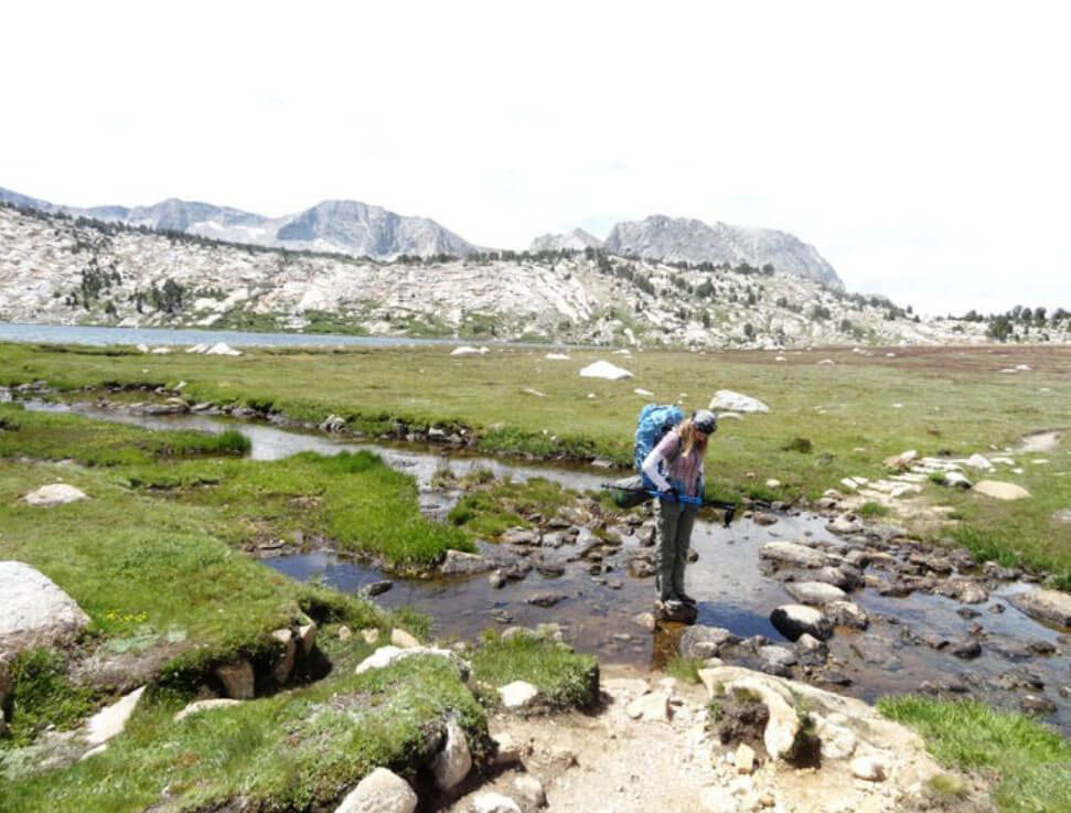
At 8,600 feet (2,621 meters) of elevation, Tuolumne Meadows spends much of the year under a coat of snow. But for a brief time between June and September, the terrain becomes a lively flowered clearing between the waves of granite peaks. Tuolumne Meadows becomes an amazing place to explore! Below is the list of day hikes I had the opportunity to check it out. For an additional list of day hikes, and the trail conditions please visit the National Park Service website.
What are the popular day hikes to explore in Tuolumne Meadows?
1. Glen Aulin Trail is packed with rich backcountry scenery, waterfalls, and stunning vistas. It is 11 miles (17.7 km) round-trip with an 800-foot of elevation gain. It takes 6-8 hours to complete the hike. The trail follows the Tuolumne River as it drops to Glen Aulin. Tuolumne Fall and White Cascade are four miles from the trailhead. The second bridge leading towards High-Sierra Camp has collapsed, and some parts of the trail are flooded.
2. Lembert Dome Trail (easy) Trail is a hike that I absolutely loved exploring! It is packed with rich panoramic views of Tuolumne Meadows. It is 2.8 miles (4.5 km) round-trip with an 850-foot elevation gain. It takes about 3 hours to complete the hike. Dog Lake and Lembert Dome can be combined into one trip. It is 4 miles (6.4 km) round-trip and it takes 4 hours to complete the hike.
3. Lyell Canyon via the John Muir Trail (easy) is 8 miles (12.9 km) round-trip hike with an elevation gain of 200-feet. The trail begins across the road from the Dog Lake parking area (shuttle stop #2). The trail passes through Lyell Canyon, along with the Lyell Fork of the Tuolumne River. For me, the trail was pretty muddy with heavy creek crossing. Spectacular Kuna Creek cascades down the side of the east canyon wall near the eight-mile mark. I did an overnight backpacking trip to the footbridge which is below the Donohue Pass. There are great vistas of Cathedral Range including Mount Maclure. I highly recommend an overnight backpacking trip. It is well worth it!
4. Mono Pass Trail is an easy 8 miles (12.9 km) round-trip hike with an elevation gain of 1,000-feet. It takes 4-6 hours to complete the hike. The trail begins at Mono Pass Trailhead Parking area, on the Tioga Road six miles east of Tuolumne Meadows (shuttle service is available twice per day). This historic, trans-Sierra trail climbs gently at first from the Mono Pass parking area, through wet meadows and rushing creeks. At the Spillway Lake junction, the trail climbs steadily and more steeply to Mono Pass (elevation 10,600 feet). There are spectacular views of Mono Lake and Bloody Canyon from the pass. Hike a bit farther toward Upper Sardine Lake.
5. Soda Springs and Parsons Memorial Lodge and Parson’s Lodge Trail is another easy 1.5 miles (2.4 km) round-trip hike. The trailhead begins at Lembert Dome parking area (shuttle stop #4). It takes about an hour to complete the hike. Walk along the gravel road and pass the locked gate (signed Glen Aulin and Soda Springs). Soda Springs is carbonated, cold water bubbling out of the ground and it is protected within a log enclosure. For thousands of years, animals and people have visited these springs. Deer and birds obtain needed minerals. People enjoy the taste of the spring water. These small, carbonated mineral springs area is a mystery. Even geologists cannot explain why they are here. Although the bubbling water comes out of the ground pure and clean, there is a possibility that people or animals have contaminated the water. Historic is a memorial to Edward Taylor Parsons, a New Yorker who joined the Sierra Club about 1900, and who eventually became the club’s director from 1905 to 1914. The Parsons Memorial Lodge is a small building built in 1915 by the Sierra Club, and it was one of the earliest structures built of stone in a national park.
6. Vogelsang High Sierra Camp Area Trail is a strenuous 13.8 miles (22.2 km) round-trip hike with an 1,400-foot elevation gain. It takes 8 hours to complete the hike. The trailhead begins across the road from the Dog Lake parking area (Tuolumne Meadows Shuttle Stop #2). The first two miles of the John Muir Trail are relatively level as they follow the Lyell Fork of the Tuolumne River. At the Rafferty Creek junction, the trail begins its 1,200-foot ascent to Tuolumne Pass. Follow the signs to Vogelsang High Sierra Camp, another 160 feet higher in elevation. Hike beyond the camp to Vogelsang Lake (0.5 mile, 280-foot elevation gain) or to Vogelsang Pass (1.5 mile, 600-foot elevation gain).
Here is the link to Tuolumne Meadows Map and Area Information


you might also like
-
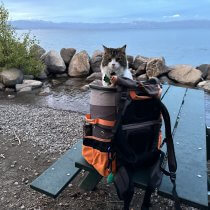
Camping with cats in Lake Tahoe
May 25, 2024
-
Sunrise Hike at Spooner Lake
September 3, 2022
-
Hiking with Pasha
August 26, 2022