My Day Hike to Mt. Conness
In: Trail Notes
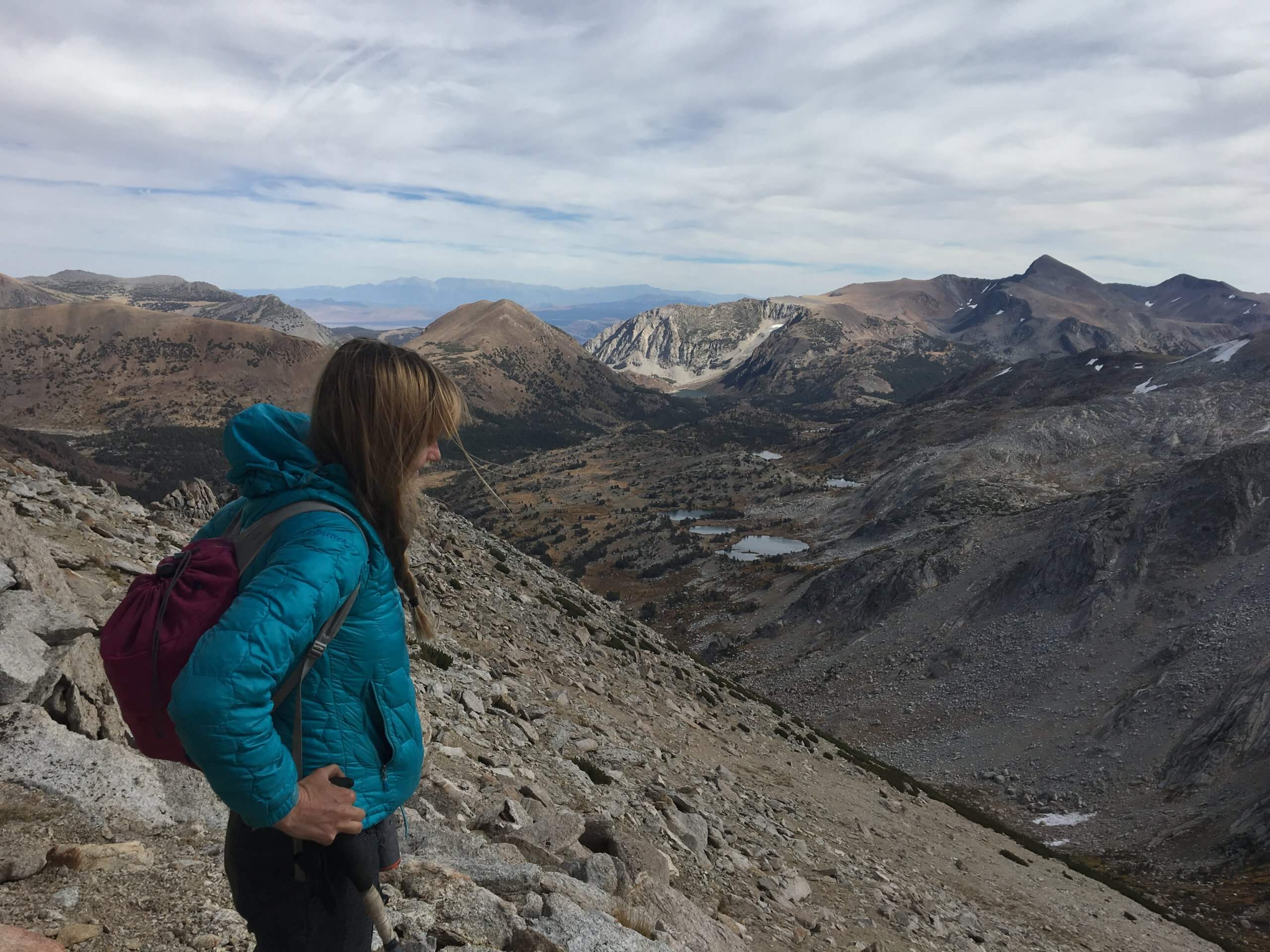
After finishing my work in Glacier National Park in Montana in the summer of 2018, I drove back to California to hike Mt. Conness in Yosemite National Park. Mt. Conness elevation is at 12,590ft. and it is the third highest peak in Yosemite. It is a striking peak with long ridges and massive vertical relief. My experience hiking the mountain was not as bad at first, but after getting to 11,000ft. I struggled finding the trail. Thankfully, I bumped into two guys from Sacramento whom I joined to hike to the top of mountain. They really did not know either where the trail went, so three of us managed to find it after scrambling for hours on the mountain looking for it. After couple of hours of hiking the trail, we found our way to the top.
Trail Information: This route starts from the Sawmill walk-in campground. If you walk through the campground you’ll eventually find yourself of a well-worn single track trail. It passes the Carnegie Institute Experimental Station and continues through beautiful high alpine meadows. As you hike higher up the drainage the trail fades away as people disperse to the different routes up the face of Conness.
You will eventually find a ‘ramp’ that leads you to the pass. Towards the top there are several likely looking chutes for the final 100 feet or so to the ridge. From here the hike is quite easy, following a use trail along the ridge to gain another 1,000 feet until it gets to the foot of the exposed ridge that leads the final 200 feet to the summit.


you might also like
-
Camping with cats in Lake Tahoe
May 25, 2024
-
Sunrise Hike at Spooner Lake
September 3, 2022
-
Hiking with Pasha
August 26, 2022