Zion National Park: My Journey Through Time and Trails
In: Trail Notes
Did you know that around 200 million years ago, Zion was a vast, barren desert? Its endless dunes of wind-blown sand closely resembled today’s Sahara. Over time, these dunes transformed into the Navajo Sandstone Formation, a monumental layer over 2,000 feet thick in some places. This formation gives Zion its dramatic monoliths, slot canyons, and towering walls. Groundwater later leached iron oxides from the upper layers, creating the striking bone-white sandstone, while the lower layers retained their distinctive rusty hues.
Later, freshwater lakes and shallow seas deposited sediment atop the Navajo sandstone, forming the layers we see today. These geological processes have shaped the breathtaking landscapes that make Zion a marvel of nature.
Zion in Autumn: A Must-See Experience
Zion National Park is famous for its vibrant colors and awe-inspiring views, but visiting during the fall elevates the experience to another level. The crisp autumn air, fewer crowds, and golden foliage make October and November the perfect months to explore.
- Ideal Weather: With temperatures ranging from the low 40s to the mid-70s, fall offers a comfortable climate for hiking. Unlike the scorching summer months, when midday temperatures soar above 100°F, autumn’s mild conditions create a hiker’s paradise.
- Fewer Crowds: As the summer rush subsides, the park becomes a tranquil retreat, allowing you to fully immerse yourself in its beauty.
Top Day Hikes in Zion National Park
Zion is home to some of the most scenic and accessible trails in the U.S. Whether you’re a seasoned adventurer or a casual explorer, there’s a trail for you.
1. Pa’rus Trail
- Overview: A leisurely path along the Virgin River, suitable for wheelchairs (with assistance), bicycles, and leashed pets.
- Distance: 3.5 mi / 5.6 km (roundtrip)
- Access: Starts near the Visitor Center and continues to Canyon Junction. Shuttle stops: #1 Visitor Center or #3 Canyon Junction.
- Features: Bathrooms and water stations available at the Visitor Center.
2. Lower Emerald Pool Trail
- Overview: Leads to picturesque pools and waterfalls. Connects to Kayenta and Upper Emerald Pools Trails.
- Distance: 1.2 mi / 1.9 km (roundtrip)
- Access: Across the road from Zion Lodge. Shuttle stop: #5 Zion Lodge.
3. Weeping Rock Trail
- Overview: A short, steep trail ending at a dripping rock alcove with a stunning view.
- Distance: 0.4 mi / 0.6 km (roundtrip)
- Access: Shuttle stop: #7 Weeping Rock.
4. Watchman Trail
- Overview: Ends at a viewpoint with incredible vistas of lower Zion Canyon, Watchman Peak, and Springdale.
- Distance: 3.3 mi / 5.3 km (roundtrip)
- Access: Shuttle stop: #1 Visitor Center.
5. Upper Emerald Pool Trail
- Overview: A sandy, rocky trail leading to a pool at the base of a cliff.
- Distance: 1.0 mi / 1.6 km (roundtrip)
- Access: Shuttle stops: #5 Zion Lodge or #6 The Grotto.
6. Kayenta Trail
- Overview: An unpaved climb connecting The Grotto to the Emerald Pools Trails.
- Distance: 2.0 mi / 3.2 km (roundtrip)
- Access: Shuttle stop: #6 The Grotto.
7. Canyon Overlook Trail
- Overview: A rocky, uneven trail ending at a viewpoint overlooking Pine Creek Canyon and lower Zion Canyon.
- Distance: 1.0 mi / 1.6 km (roundtrip)
- Access: Parking near the Zion-Mt. Carmel Tunnel (no shuttle access).
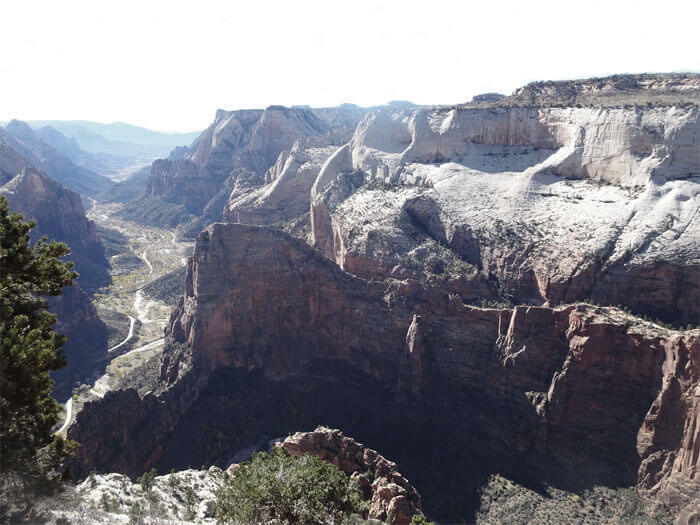
8. Angels Landing via West Rim Trail
- Overview: Famous for its narrow ridge and steep drop-offs, this trail is not for the faint-hearted.
- Distance: 5.4 mi / 8.7 km (roundtrip)
- Access: Shuttle stop: #6 The Grotto.
9. Hidden Canyon Trail
- Overview: Follows a cliff face to the mouth of a secluded canyon.
- Distance: 2.5 mi / 4.0 km (roundtrip)
- Access: Shuttle stop: #7 Weeping Rock.
10. Observation Point via East Rim Trail
- Overview: A challenging climb through Echo Canyon to a stunning viewpoint above Zion Canyon.
- Distance: 8.0 mi / 12.9 km (roundtrip)
- Access: Shuttle stop: #7 Weeping Rock.
11. The Narrows via Riverside Walk
- Overview: This iconic hike involves wading and sometimes swimming through the Virgin River. Be prepared for cold, slippery conditions and check weather and flash flood warnings before heading out.
- Distance: 9.4 mi / 15.1 km (roundtrip)
- Access: Shuttle stop: #9 Temple of Sinawava.
Tips for a Safe and Enjoyable Visit
- Stay Hydrated: Always carry plenty of water, even during cooler months.
- Check Conditions: Obtain the latest weather updates and trail information before setting out.
you might also like
-
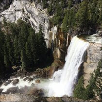
Exploring Yosemite’s Waterfalls: My Favorite Spring Hikes
July 30, 2020
-
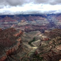
7 Must-See Day Hikes on the North Rim of the Grand Canyon
October 28, 2018
-
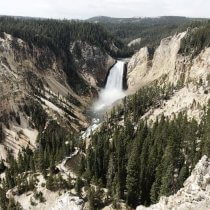
From Geysers to Canyons: My Adventure Through Yellowstone’s Best Day Hikes
August 30, 2018