My Unforgettable Hiking Adventures in Two Medicine Valley: 9 Trails You Can’t Miss
In: Trail Notes

What I’ve Learned About Hiking in Two Medicine Valley
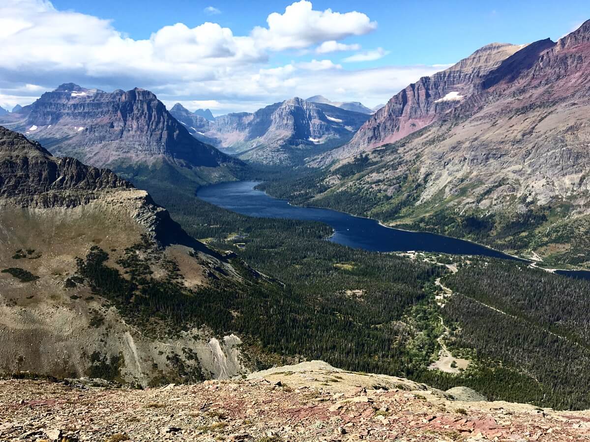
Two Medicine Valley, a remote gem in Glacier National Park, offers some of the most pristine and breathtaking scenery you’ll find anywhere. Hiking here takes you past waterfalls, cliffs, caves, and breathtaking vistas. This area is truly wild and untouched, providing an immersive experience for those willing to explore on foot. The eastern side is notorious for its powerful winds, frequently gusting over 60 mph near Maria Pass and the Two Medicine area. These gusts are so intense that they can knock you off the trail or even move your body while you’re climbing. Some hikers have to crawl down the trail on their hands and knees to make it to safety. The dramatic weather at the Divide, where Pacific and Arctic air masses clash, means temperatures can drop by as much as 100 degrees in just 24 hours. Hiking in such extreme winds can be dangerous, so it’s important to avoid this type of weather when planning your hike.
9 Must-Do Day Hikes in Two Medicine Valley
- Scenic Point (Strenuous) – A challenging half-day hike, this 3.8-mile trek from Two Medicine Road to Scenic Point offers panoramic views across the high plains, all the way to the Sweetgrass Hills, about 100 miles away. If you’re up for more, a 10-mile backpacking trip to East Glacier with a 2,300-foot elevation gain is also an option.
- Cobalt Lake – Two Medicine Pass (Strenuous) – The views from Two Medicine Pass are absolutely stunning! A 5.7-mile one-way hike from the lower boat dock to Cobalt Lake sets the stage, and a further 2 miles to the pass with an elevation gain of 1,000 feet completes the challenge.
- Dawson-Pitamakan Pass Loop (Strenuous) – For a multi-day adventure, the 17.2-mile Dawson Pass and Pitamakan Pass Loop offers some of the most scenic and lightly trafficked routes in the park. This hike is best for experienced adventurers looking to push themselves.
- Triple Divide Pass (Strenuous) – A hike to the top of Triple Divide Pass offers breathtaking views and a chance to join thru-hikers on the Continental Divide Trail. The sweeping vistas of the surrounding peaks make this trail one of my favorites.
- Siyeh Pass (Strenuous) – This high-elevation trail takes you through two passes on your way around Going-to-the-Sun Mountain. The 4.7-mile, 2,240-foot climb from Siyeh Bend to Siyeh Pass is rewarding, with spectacular views along the way.
- Piegan Pass (Strenuous) – Connecting the St. Mary drainage with Many Glacier, Piegan Pass offers incredible views of Blackfoot, Jackson, and Piegan glaciers. It’s a tough climb, with a 1,670-foot elevation gain, but the views make it worthwhile.
- Aster Falls (Moderate) – A short, scenic hike that begins at the South Shore Trailhead at Two Medicine Lake. After crossing Aster Creek, you’ll reach the Aster Park Trail, which leads to Aster Falls and an incredible overlook.
- Rockwell Falls (Moderate) – A 6.6-mile out-and-back hike to Rockwell Falls, beginning from the South Shore Trailhead. The view of Sinopah Mountain, Lone Walker Mountain, and Flinsch Peak creates a perfect backdrop for this easy-to-follow trail.
- Running Eagle Falls (Easy) – Also known as “Trick Falls,” this is an easy, handicap-accessible 0.6-mile round-trip trail with an elevation gain of just 15 feet. The falls are unique because they contain two separate waterfalls, which change depending on the season. During the spring run-off, the top falls create a dramatic 40-foot drop, while the lower falls become more prominent later in the summer.
you might also like
-

Zion National Park: My Journey Through Time and Trails
July 30, 2021
-
Exploring Yosemite’s Waterfalls: My Favorite Spring Hikes
July 30, 2020
-

7 Must-See Day Hikes on the North Rim of the Grand Canyon
October 28, 2018
